Bryce Canyon National Park – Your ultimate guide for the trip
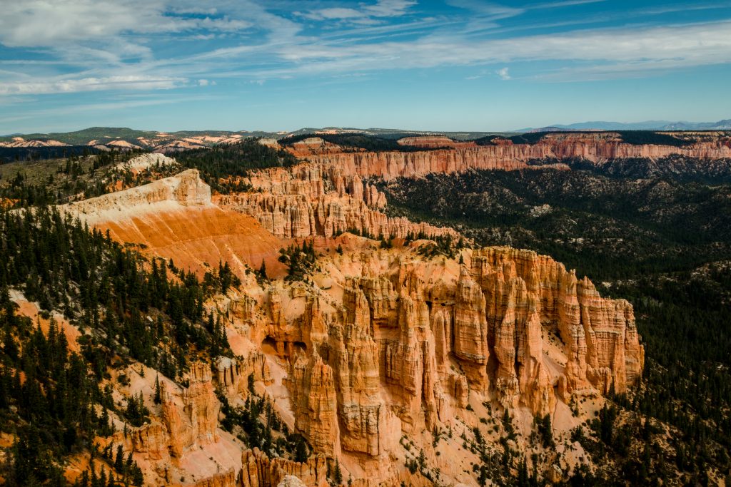
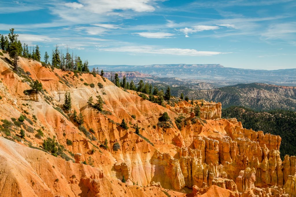
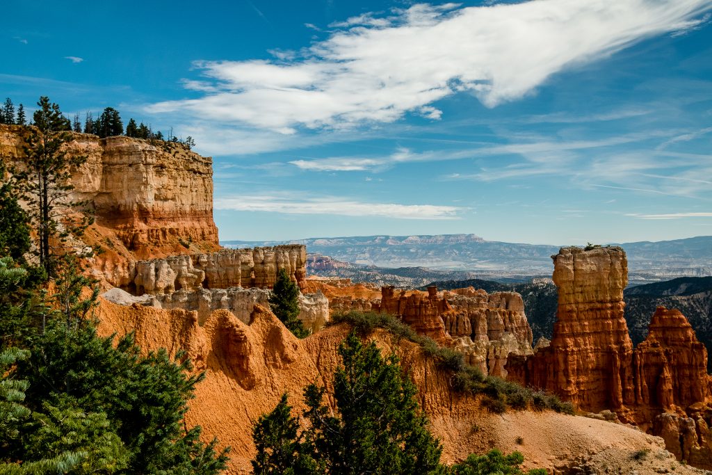
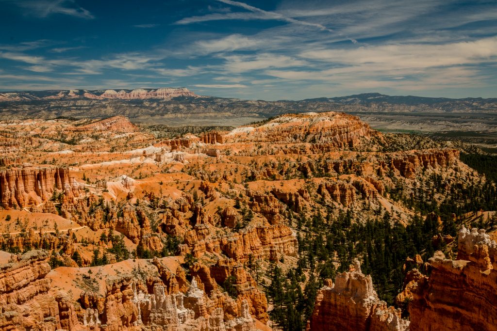
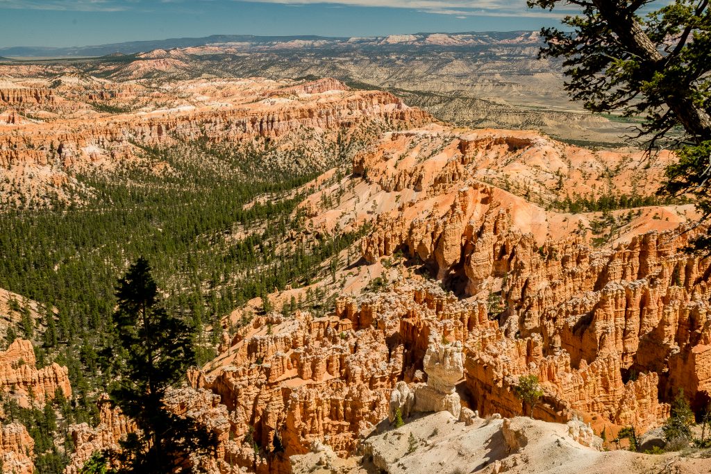
The most liked park on our entire trip for its maintenance and accessibility is Bryce Canyon National Park – a favorite for many of my friends on the trip. My personal favorite is Arches National Park. But Bryce is no less than Arches in its beauty. There is no place like Bryce and its real beauty lies in the rocks. The park is well maintained and all the viewpoints have paved wheelchair accessible pathway. A visit to the park is an otherworldly experience which cannot be summarized in words. None of the photos can do justice to the crimson-colored hoodoos, fins, and goblins. With so much to see in the park, it’s overwhelming for everyone who visits for the time, hence, I highly recommend to do proper planning before your visit! A little knowledge about the park will be very helpful. Hope this post makes your task easier.
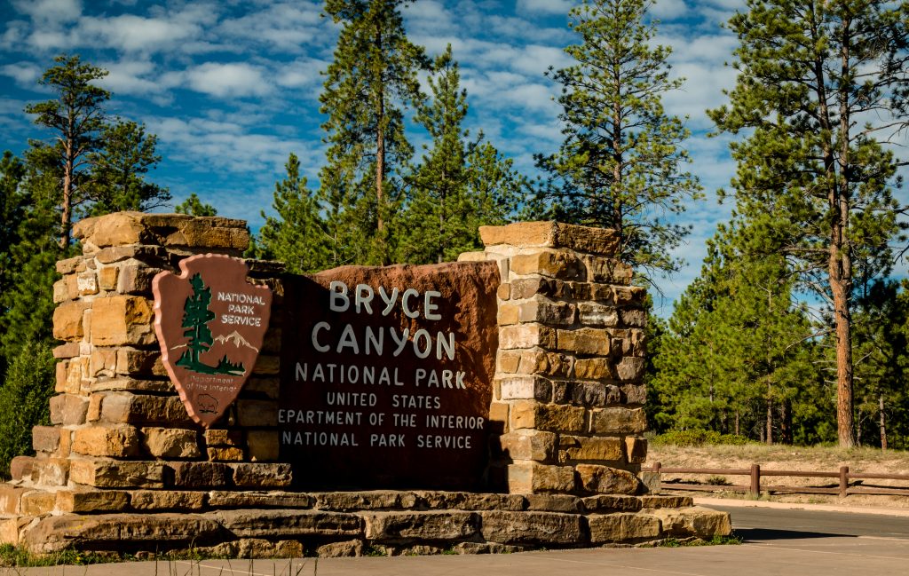
Bryce Canyon National Park – What is it?
Bryce Canyon is ranked 13 among all the National Parks in the United States. Bryce Canyon lies on the eastern edge of the Paunsaugunt Plateau in south-central Utah. Bryce is well known for its unique geology – a series of horseshoe-shaped amphitheaters carved from the eastern edge of the Paunsaugunt Plateau in southern Utah. The park was named to honor the Mormon settlers – Ebenezer Bryce, who homesteaded in the area in 1874. The rim of the plateau is bordered by diverse flora and fauna – Ponderosa pines, high elevation meadows, and fir-spruce forests; hence the weather across the park will be changing and boasts some of the world’s best air quality.
Bryce Canyon – What is it known for?
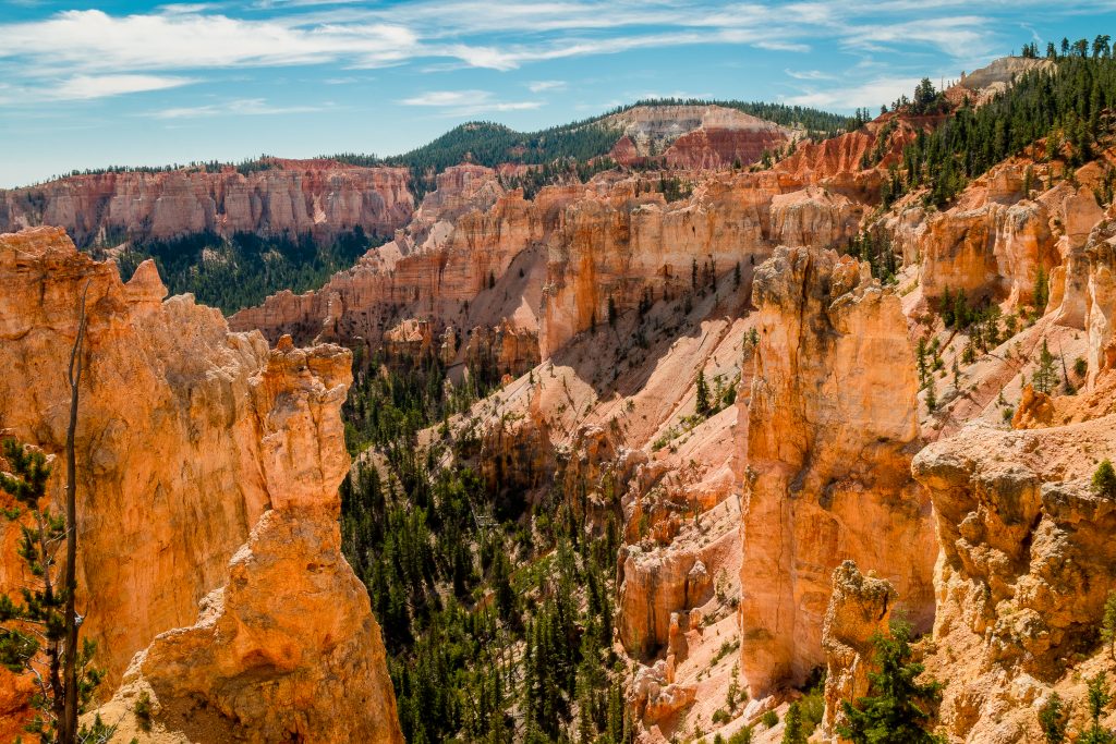
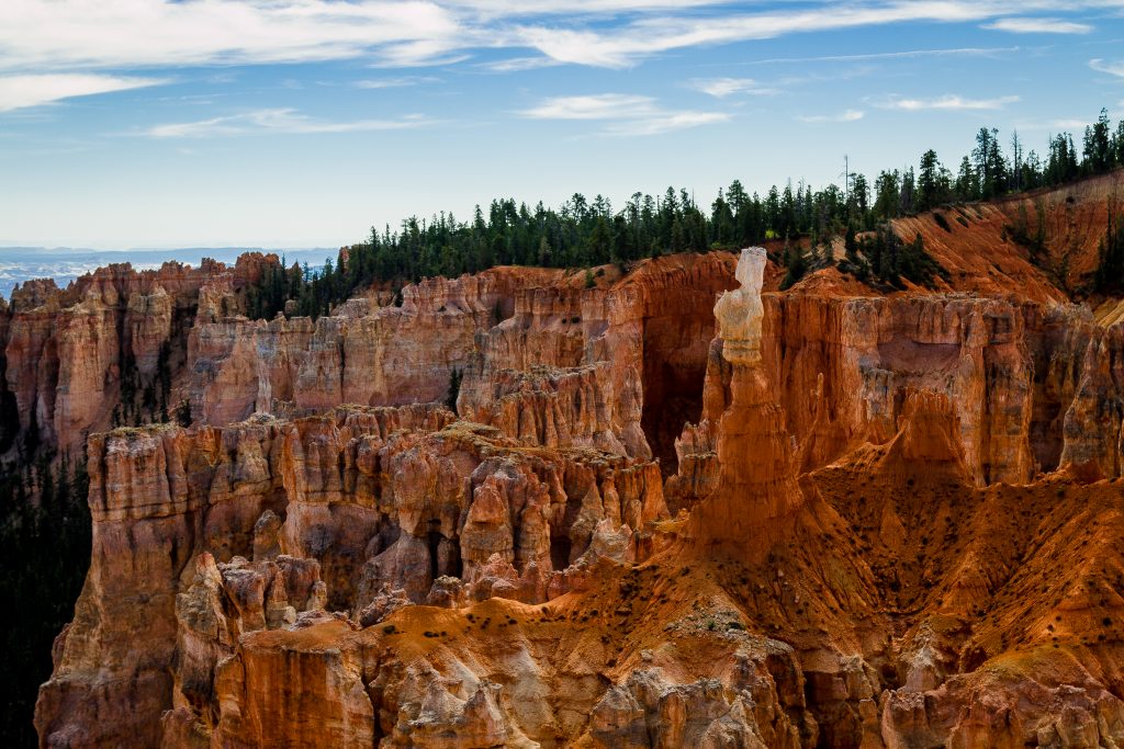
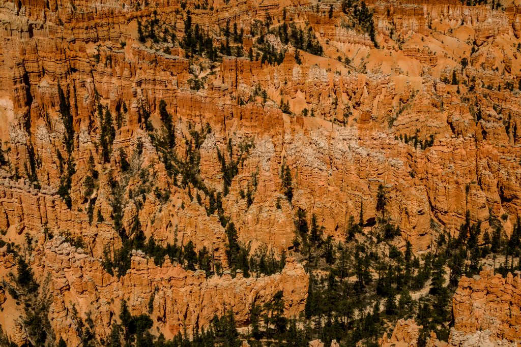
Hoodoos! Yes, Bryce is well known for Hoodoos.
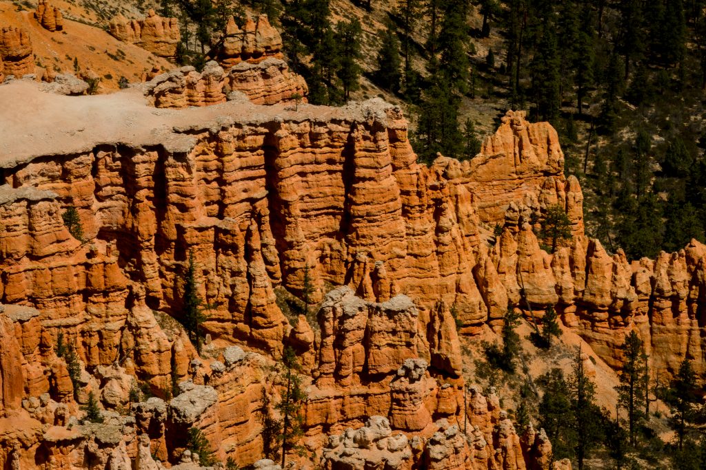
Bryce Canyon is not really a Canyon as it is not carved by the flowing water; even then water is the active ingredient here but in the form of frost-wedging and chemical weathering. Weathering and erosion shape these picturesque rock features. As snow and ice melt, water seeps into fractures. As it re-freezes, it expands and cracks the rock around it. This common process of frost-wedging happens with uncommon frequency at Bryce Canyon. The forces of weathering and erosion never rest, not even for a day. Isn’t that surprising?
What are Hoodoos?
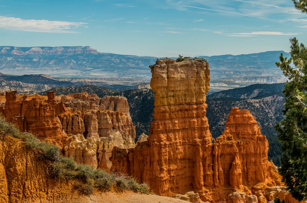
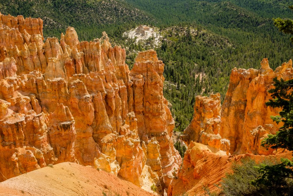
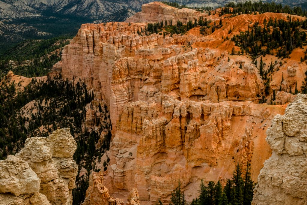
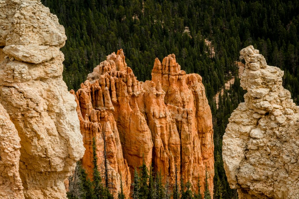
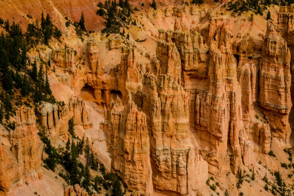
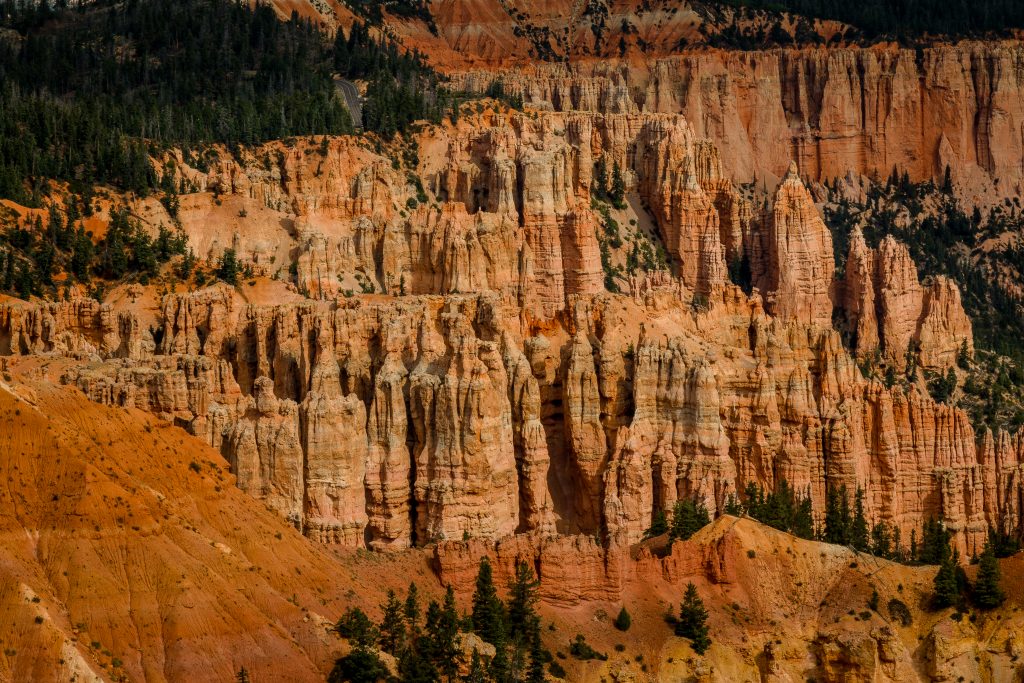
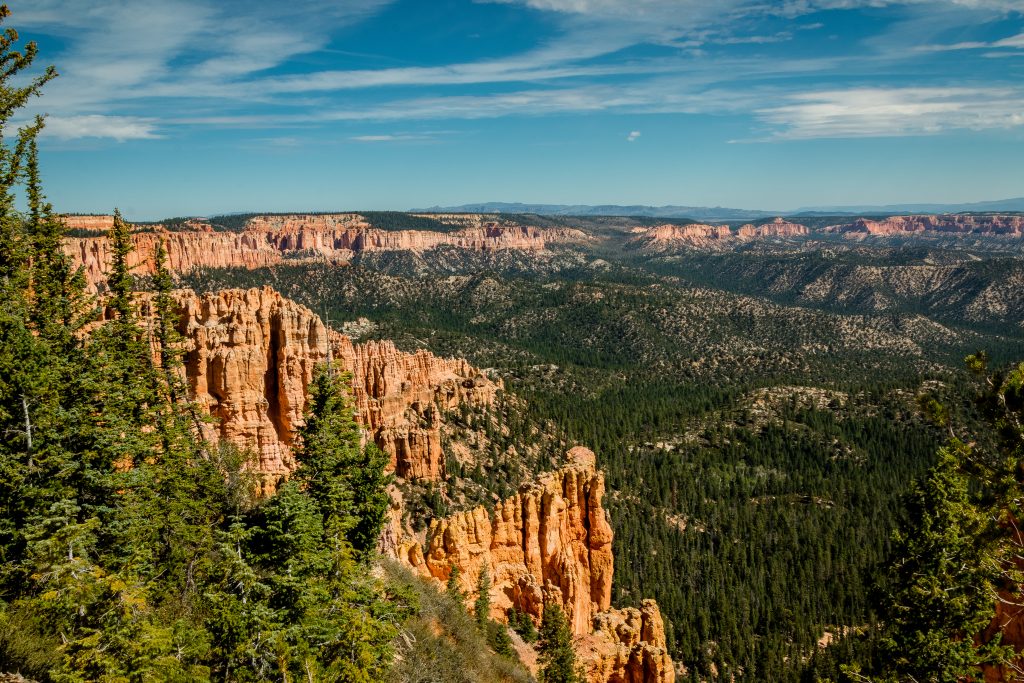
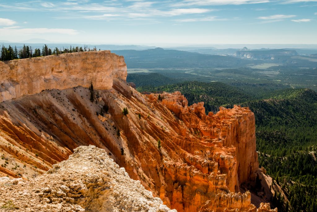
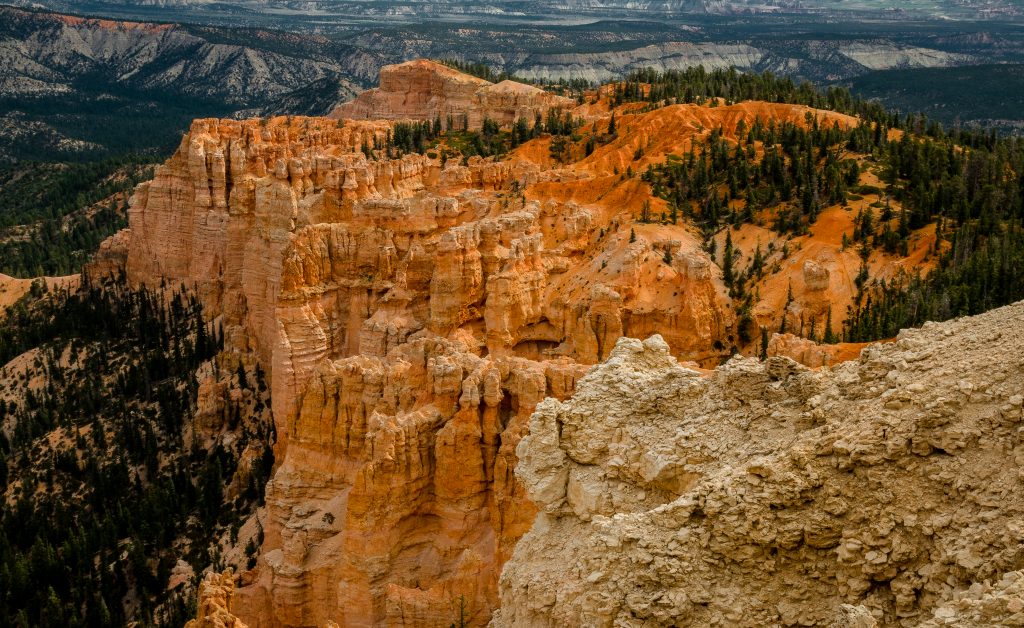
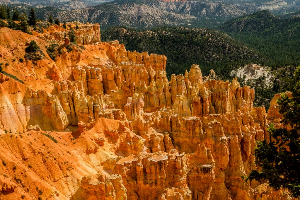
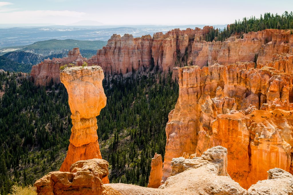
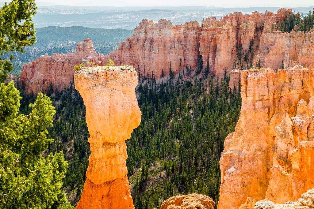
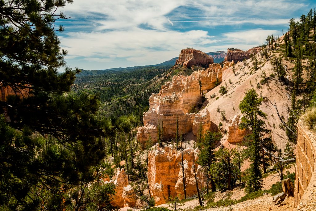
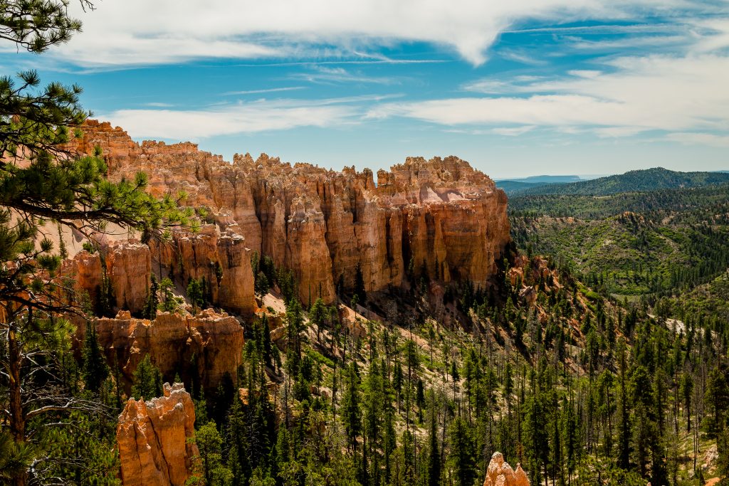
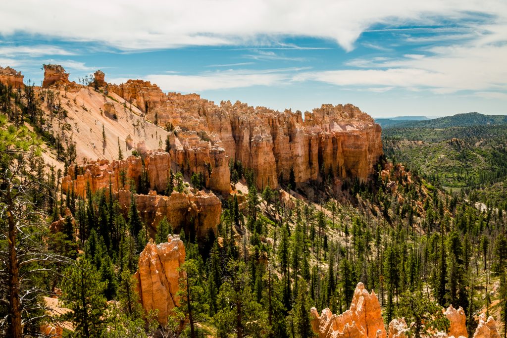
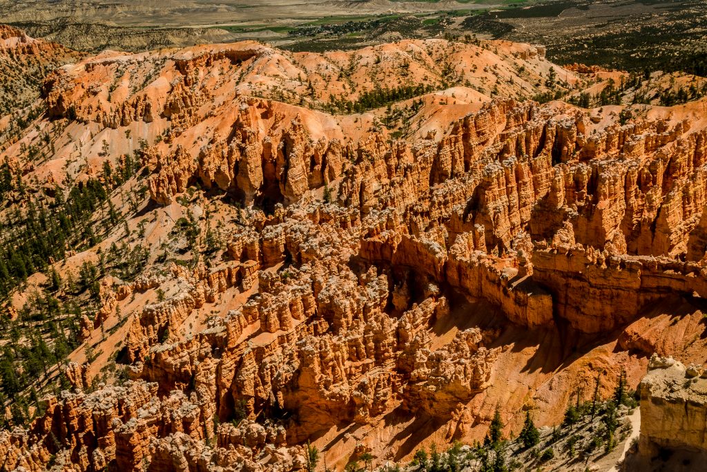
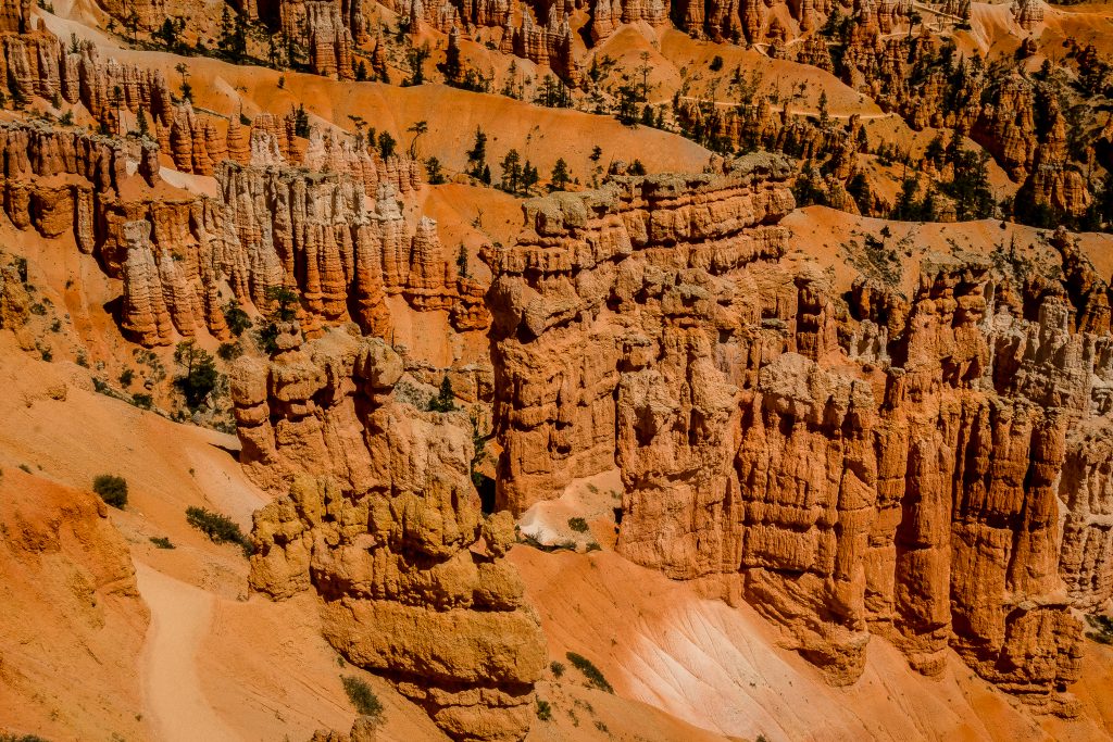
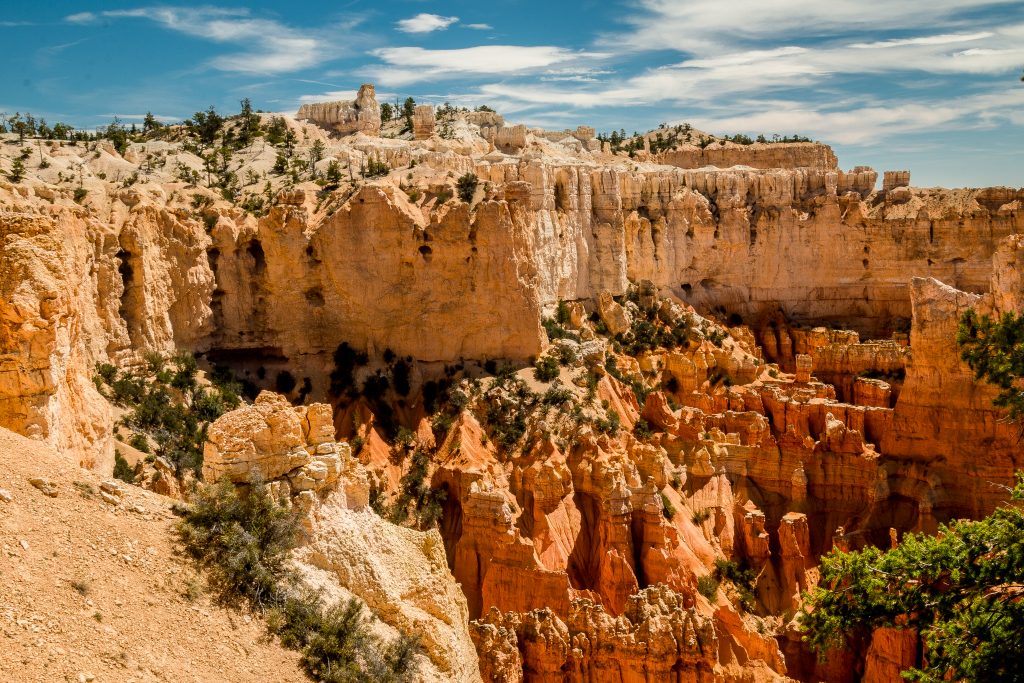
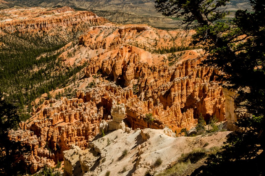
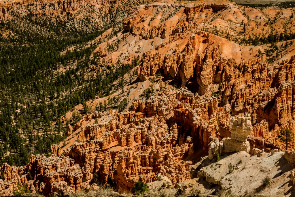
Hoodoos are tall skinny spires of rock that protrude from the bottom of arid basins and “broken” lands. The hoodoos are abundant in the northern section of the Bryce Canyon National Park. They don’t grow like trees but are eroded out of the cliffs where rows of narrow walls form. These thin walls of rock are called fins. Frost-wedging enlarges cracks in the fins, creating holes or windows. As windows grow, their tops eventually collapse, leaving a column. Rain further dissolves and sculpts these limestone pillars into bulbous spires called hoodoos. The delicate climatic balance between snow and rain ensures that new hoodoos will emerge while others become reduced to lumps of clay.
Bryce Canyon – How to access?
The entire scenic 14-mile drive can be accessed by your own vehicle if you arrive earlier and find parking lot inside the park. In case if you want to have a hassle-free drive, then I highly recommend you to take a park shuttle. There are two shuttles available in the park – Free Bryce Amphitheater Shuttle and Rainbow Bus Tour.
Free Bryce Amphitheater Shuttle is available for every 10-15 minutes at various points – Shuttle Station, Visitor Center, Campground and Lodging areas.
Rainbow Bus Tour: Free shuttle operated twice a day which takes you along the 18-mile scenic drive and overlooks along the drive. The shuttle is available at 9 AM and 1:30 PM.
FAST FACTS:
- The scenic drive runs through the entire rim of the park from Visitor Center to the Yovimpa viewpoint.
- All the viewpoints have a paved path and it is wheelchair accessible.
- Ensure to carry enough water bottles as you might get exhausted because of the heat.
- The food outlets are available in the viewpoint – Bryce Lodge and you will find a water filling station also there.
- There is no connectivity inside the park; hence I highly recommend you to grab a park map from the visitor center to know about the trails and hikes.
Bryce Canyon National Park – Facility Hours:
- The park is open all year except Christmas, Thanks Giving Day & New Year and the park has entry fees – $35 per vehicle.
- The facility hours may vary according to the season, hence please check the facility hours in the park website here – https://www.nps.gov/zion/planyourvisit/conditions.htm
- To avoid the park fees and if you are planning to visit multiple National Parks in the year, then I highly recommend you to purchase the annual pass here – America the beautiful pass. The cost of the pass is $80 and it is valid for 1 year from the date of purchase. The park is accepted in all the parks managed by NPS and Federal Lands.
Bryce National Park – Where to stay?
There are a number of options with the basic amenities to stay in and around the park. We stayed in an Airbnb in the town – Glendale and it is 45 minutes away from the park. There are a number of lodging options available in the nearby town – Kanab. If you love adventures and camping, then there are two campgrounds available inside the park – North Campground and Sunset Campground.
Bryce Canyon National Park – Must Do’s
- Drive across 11-mile scenic drive inside the Bryce Canyon National Park
The park shuttle is the most convenient way to visit the park and I highly suggest to arrive at the park in the early morning to avoid the crowds and also to park your vehicle in the Parking lot. If you prefer to enjoy the viewpoints in your own pace, then you can drive across with your own vehicle. We used our own vehicle as we visited during weekdays and it was less crowded, making it more convenient to drive along the scenic drive.
The park has 9 viewpoints
- Visitor Center:
Ensure to stop at the visitor center and grab a map of the park.
- Bryce Amphitheater:
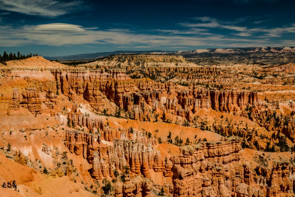
The first three miles of the park is known as an amphitheater. The most iconic and popular view of Bryce Canyon is found along the rim of the amphitheater – Bryce, Sunset, Inspiration and Sunset point. The hoodoos in the viewpoint look phenomenal in the early morning when the first rays of the sun fall on the crimson red colored rock formations and brighten them.
- Sunrise Point, Sunset Point & Inspiration Point
The best view of the park is viewed from Sunrise and Sunset point. The points are easily accessible using a paved pathway. The entire rim of the amphitheater can be viewed from the points and the view from the Inspiration is incredible.
The breathtaking scenery cannot be explained in words and one has to experience it in person to appreciate the beauty. We walked along the paved portion of the rim trail from Sunset to Sunrise point. It’s a 0.5 mile each way and one of the easiest hike with views of the scenic Bryce Amphitheater.
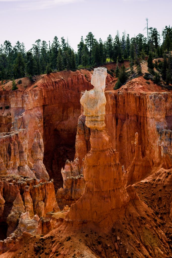
The famous Navajo Loop trail is accessed from the Sunset point. It takes almost 2-3 hours where you will walk down the Amphitheater and one can see Thor’s Hammer and two bridges on the way. Usually, clockwise direction is recommended. Ensure to carry water bottles. Know your limits. We decided to do the hike but then we couldn’t continue because of the temperature in the area, hence we had to return back on our way. If you are an adventure seeker, you can combine Queen’s Garden trail with the Navajo and complete the entire loop. Queen’s Garden Trail is accessed from Sunset Point where you will hike down to view Queen Victoria hoodoo.
- Bryce Point
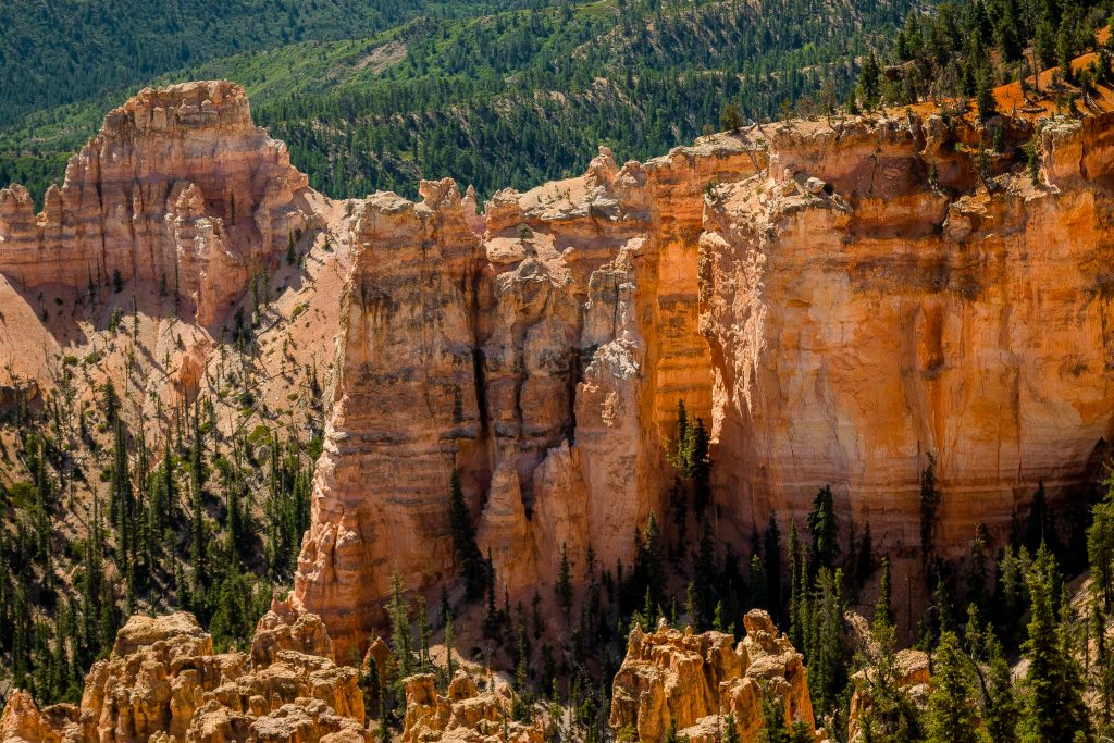
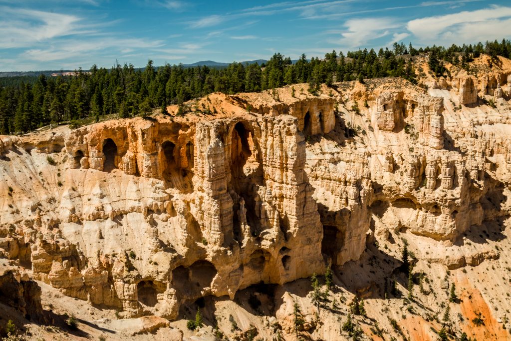
The must do even if you are planning to spend only a few hours inside the park. The viewpoint is accessible only during summer. The viewpoint is well known for extraordinary sunrises and the panoramic view of the entire amphitheater amazes every visitor. The grottos, also visible from Bryce Point, are the result of erosion of softer pockets of the upper White Member of the Clarion Formation. The top of the hoodoos is lit brightly when the sun is bright and the orange light spreads driving shadows into the deepest recesses of the Amphitheater creating a spectacular show.
The Peekaboo Loop trail is accessed from the Bryce Viewpoint. The Peek-a-boo Loop Trail is a steep but spectacular hike past the Wall of Windows and the Three Wise Men.
Bryce point is a popular hangout for Golden-mantled Ground Squirrels and Uinta Chipmunks. You might find some on your way.
- Paria View
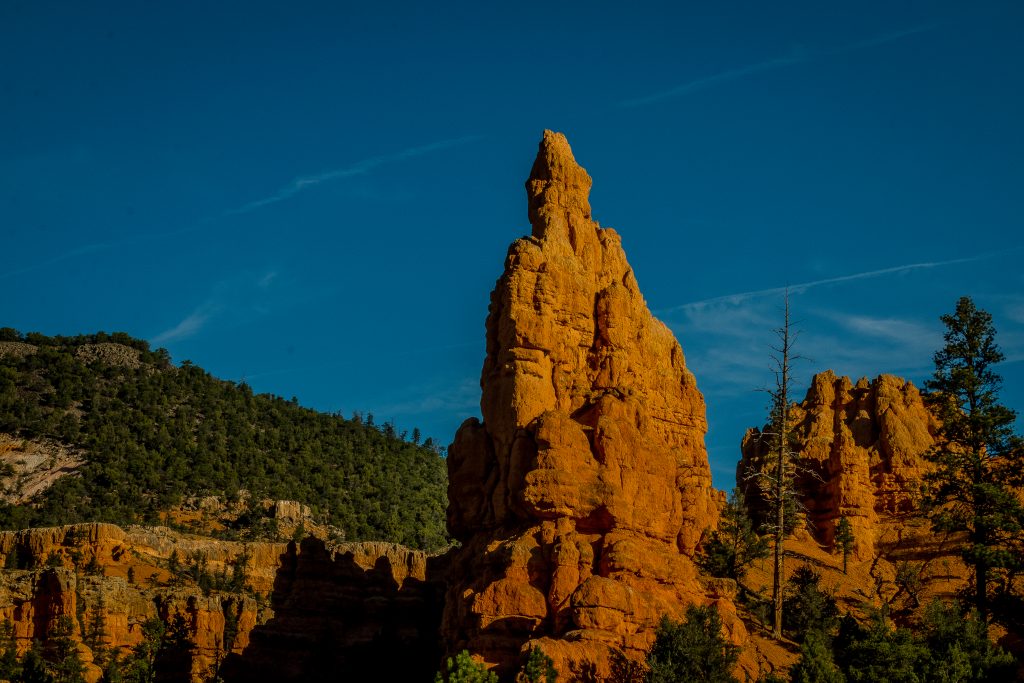
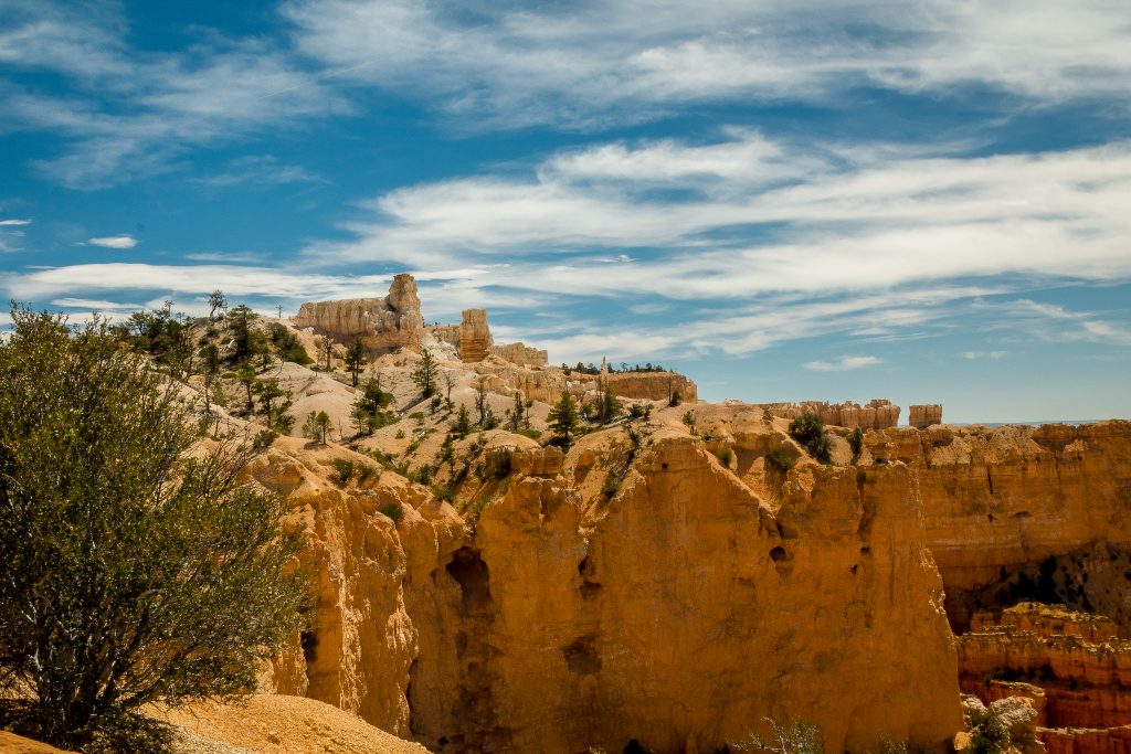
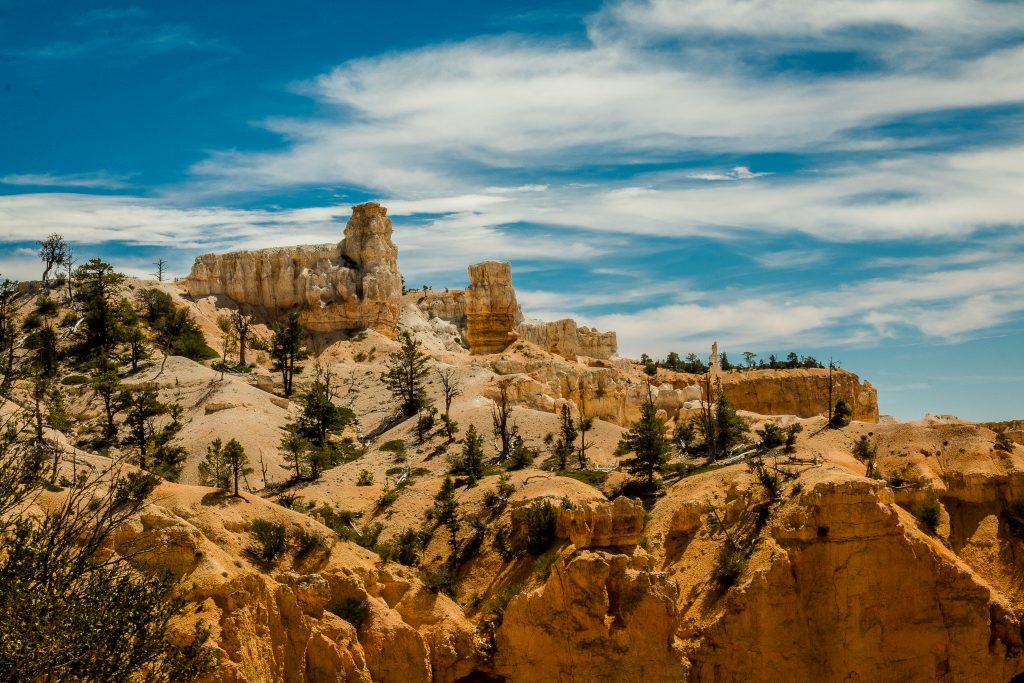
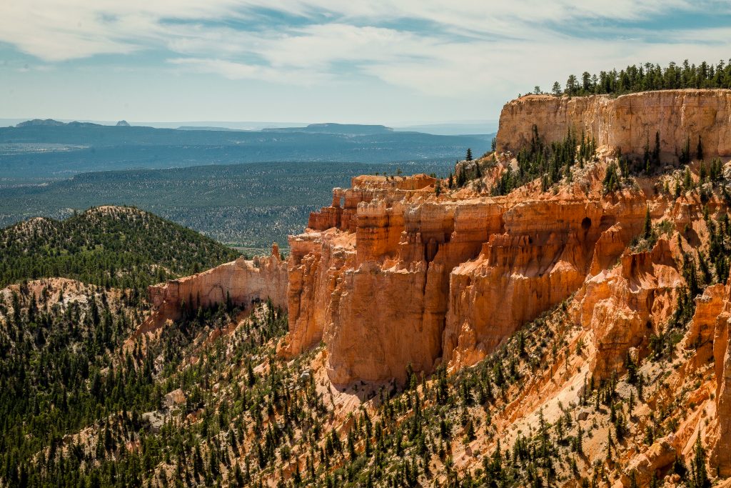
Paria View is Photographer’s dream come true. Most of the cliffs and hoodoos of Bryce Canyon face the setting sun which creates a photogenic spot for a photographer. A photogenic castle-like hoodoo rises above the canyon floor to absorb the last rays of the sun. Paria is a Paiute word meaning “water with elk” or “water with mud”. The area is also known for slot canyons.
- Swamp Canyon
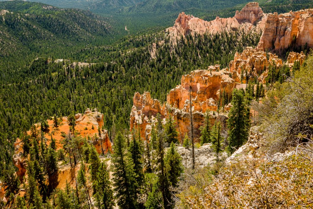
Swamp Canyon appears relatively small and sheltered from the overlook, bounded on both sides by fins and hoodoos. This size allows the viewer to develop a more intimate connection with the landscape than some of the grander viewpoints may provide. One can see broken arches hoodoos.
- Farview Point
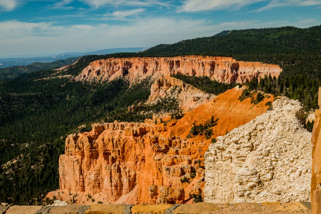
This is one of Bryce Canyon’s most valued assets. The Grand Staircase can be viewed from the point and one can see the spectacular landmarks – Aquarius Plateau (Pink Cliffs), the Kaiparowits Plateau (Grey Cliffs), and Molly’s Nipple (White Cliffs) from the point. The magnificent results of view are due to the extremely high air quality, with potential visibility as far away as the Black Mesas in Arizona — up to 160 miles! A very short and flat trail which leads to Piracy Point is accessed from here, where two large buttes appear as sailing ships in the naval battle.
- Natural Bridge
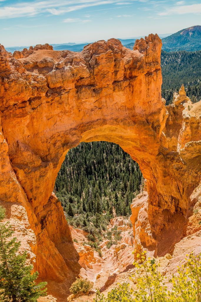
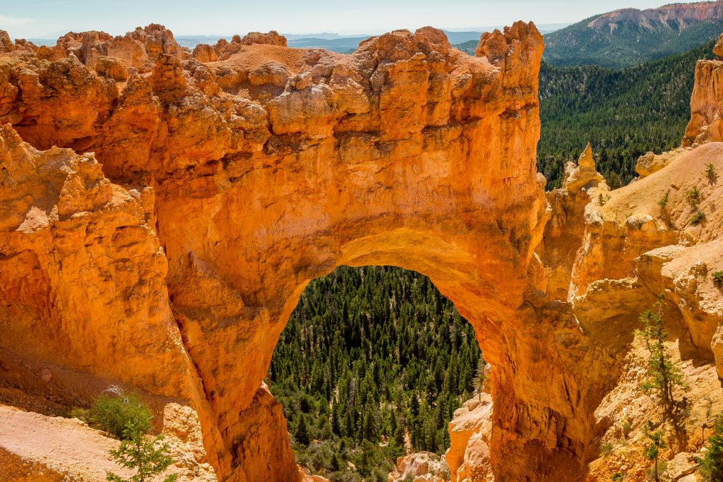
Natural Bridge is one of the beautiful arches in the Bryce Canyon. The arch is sculpted from the reddest rock of the Calron formation which poses a stark contrast to the dark green of the Ponderosa forest that peeks through the arch from the canyon below.
- Aqua Canyon
The two prominent hoodoos – The Hunter and The Backpacker is viewed from the viewpoint. Watch out for California Condor from the viewpoint. When the condor stretches its feather, it will be the size of the stretched arm.
- Ponderosa Canyon
Named after the huge Ponderosa pines on the Canyon floor. You can see the different types of rocks that encompass the Grand Staircase.
- Black Birch Canyon
A small overlook which demonstrates how precipitously the cliffs drop from the road. It also offers an up-close look at hoodoos – though these are modest in comparison to those at Bryce Amphitheater.
- Rainbow and Yovimpa Points
This is the highest elevation point in the park exceeding above 9100 ft. You have to walk on the opposite side of the parking lot to reach Yovimpa point from Rainbow point. You can get a good look at the sequence of rock layers of Grand Staircase. The point is named after the color of the rocks here.
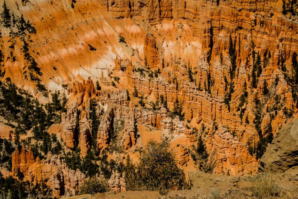
We reached the Visitor Center around 8 AM in the morning and we directly headed to the Yovimpa point. We took the Highway 12 from Glendale to reach Bryce Canyon National Park and I should say it is one of the most scenic drives that we visited. Highway 12 passes through the Red Canyon and a number of Canyon Arches. There is a short loop road to view the Red Canyon. We visited all the viewpoints and finally saw the orientation film about the park. Never miss the orientation film which explains the history and geology of the park.
We wanted to do the hike – Navajo Loop Trail as we wanted to see Thor’s Hammer and Two Bridges. Though Thor’s Hammer can be viewed from the Sunset viewpoint, the two bridges can be viewed only when doing the hike. One has to walk through the hoodoos and descend down the amphitheater to view the bridges.
- Do Day Hikes
If you have more than half a day, then I would highly recommend you to do a day hike. Grab a hiking guide from the visitor center. Some of the most famous hikes in the Bryce Canyon National Park is
Navajo Loop: Moderate hike accessed from Sunset Point – 1.3 miles round loop. One can see Thor’s Hammer and Two Bridges along your way.
Sunset to Sunrise: One of the easiest hike on the paved portion of the Rim Trail. 1 mile round loop with the views of the scenic Bryce Amphitheater.
Queen’s Garden: Easiest hike descending down into the Bryce Amphitheater to get a glimpse of Queen Victoria hoodoo.
Queen’s/Navajo Combination Loop: The most popular trail in the park which combines both Queen’s Garden and Navajo Loop.
Mossy Cave: The easiest hike which takes around an hour where you will walk up the streamside to a mossy grotto that fills with spectacular icicles in winter and dripping mosses in summer.
- Drive across the scenic Highway 12
If you have more time to explore, then I would highly recommend you to take a drive on Highway 12. Highway 12 passes through Red Canyon and also Canyon arches.
Bryce Canyon National Park is a visual treat with crimson colored hoodoos and canyons. And Bryce Canyon is easily reached from Zion Canyon National Park; hence if you plan to visit Zion, I would highly recommend you to visit Bryce Canyon National Park and I am sure you will never regret about it.
With this, we completed the second National Park in Utah 5 road trip. We completed our visit by midafternoon and we then headed towards Loa for our next National Park – Capitol Reef National Park.
If you like my travelogue and wish to follow my travel stories further, then do like and follow my profile here – Facebook, Google, Instagram
Thanks,
Karthi
Facts gathered from the Park Website and the Pamphlets. The pictures in the post are clicked by me. The content and the pictures in the post belongs to the author. Reproduction and distribution of the content/pictures without prior permission from the author are prohibited.

